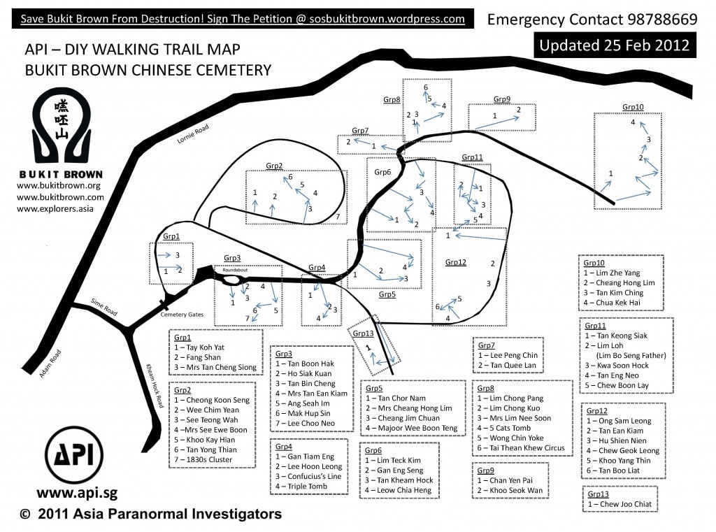
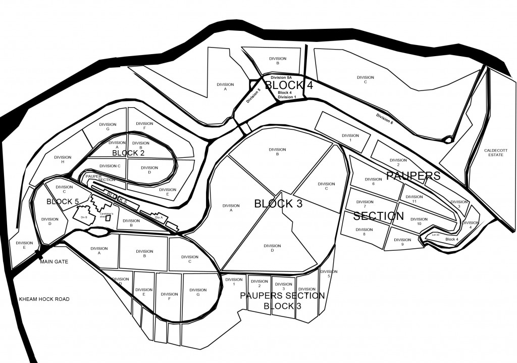
Master Maps of Bukit Brown
3
For self-guiding, please refer to our tour guides and featured tombs. Read up on tips before you visit for full enjoyment and safety. Enjoy the flora and fauna.
***
Division Map
***
We are often asked about the distances over Bukit Brown. Cyclists and runners may find these useful:
For the greater Bukit Brown cemetery complex:
Mok Ly Yng says:
The Seh Ong Cemetery was made up of 5 hills since day 1. Lornie/Adam Road only cut thru the valley between Hill 4/5 (on the golf course side) and the rest of Hills 1-3 on the BBC side. Then later on, PIE came in and cut thru the lower areas of the Hills 1 and 2.
Seh Ong had 5 hills since the area was acquired in the 19th century. Still today, the hill tops are still around, but the ‘body’ of the hills are badly bisected by the two roads (Lornie/Adam Rds and PIE).
Kheam Hock Road also cut thru a valley between the Seh Ong Hills 1 (left) and 2/3 (right), does not affect the hill count.


Comments
Trackbacks
Check out what others are saying about this post.[…] a municipal government burial ground, its size of 173 acres (total 392 acres if including surrounding cemeteries) is the burial place of […]
[…] the contributions of ordinary first-generation immigrants, and many of them are interred at Bukit Brown Cemetery. The story of my great-grandfather, C.K Lim, is one of many stories of immigrants who played a role […]
[…] Maps of Bukit Brown Residents of Bukit Brown Bukit Brown Municipal Cemetery – history and future developments […]