Sunday 18th morning @ Bukit Brown, Nature Society’s Angie Ng conducted a plant walk and shared what she knew about plants which are used as herbs in local dishes and fruit trees. Here are some of the highlights
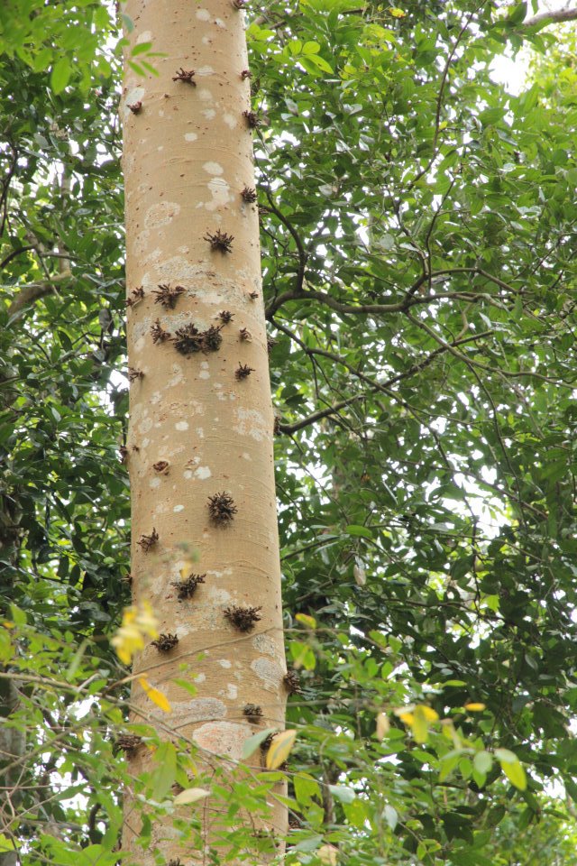
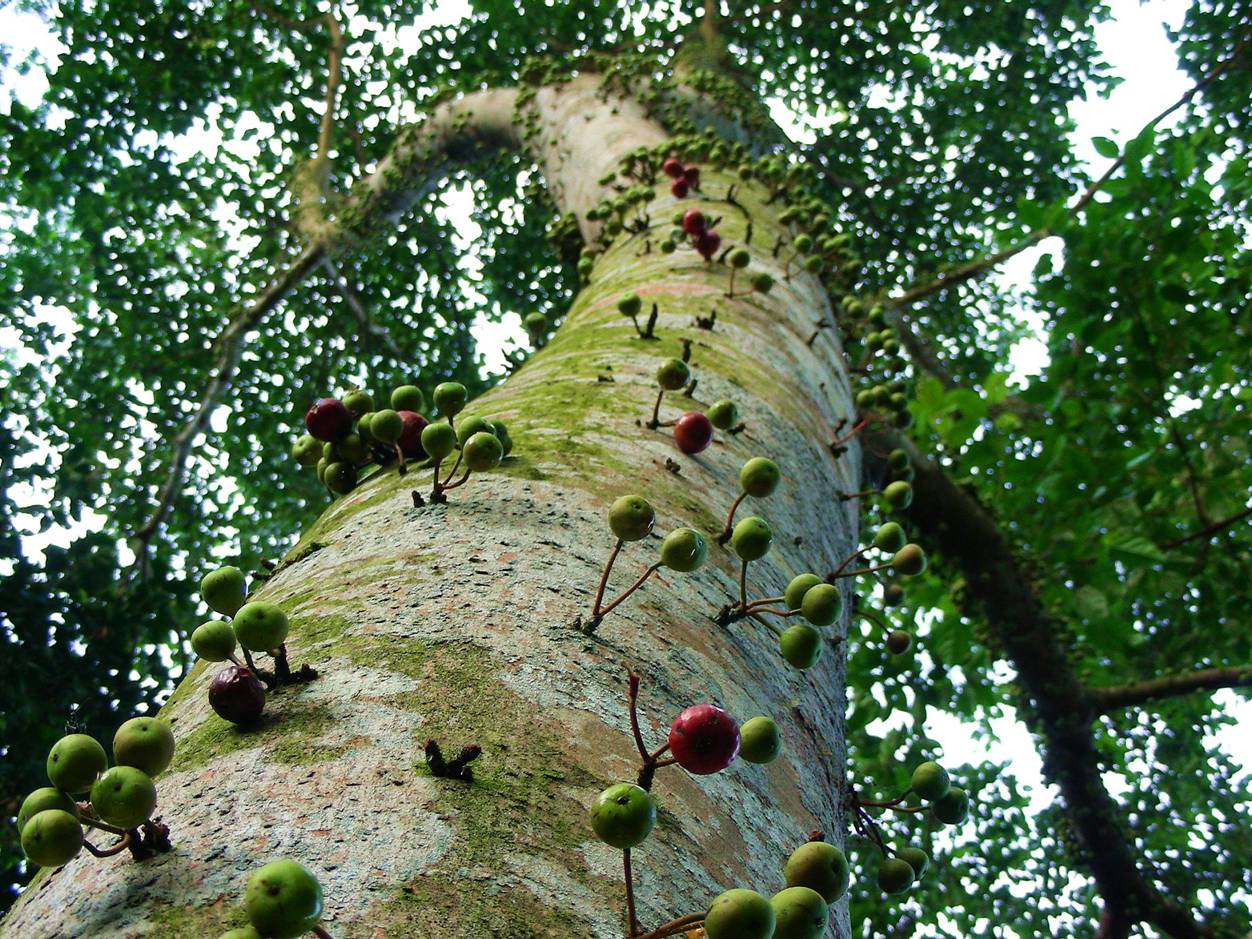
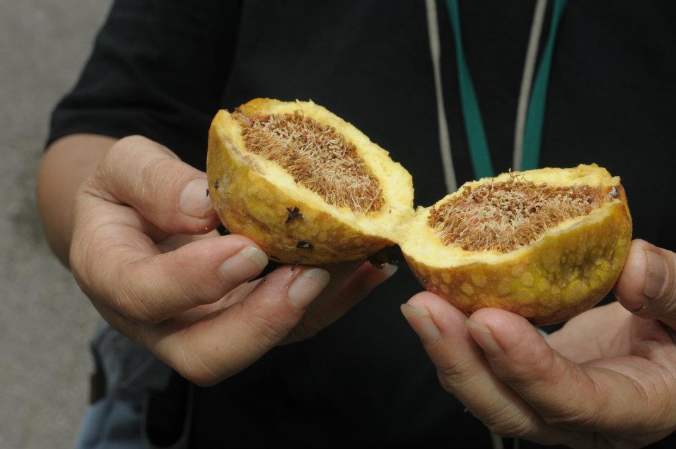
Red Stem-fig tree ( Ficus variegata)
Ferns grow close to the ground
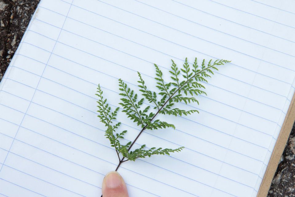
An edible fern found at the foot of hill leading up to Ong Sam Leong’s gravesite
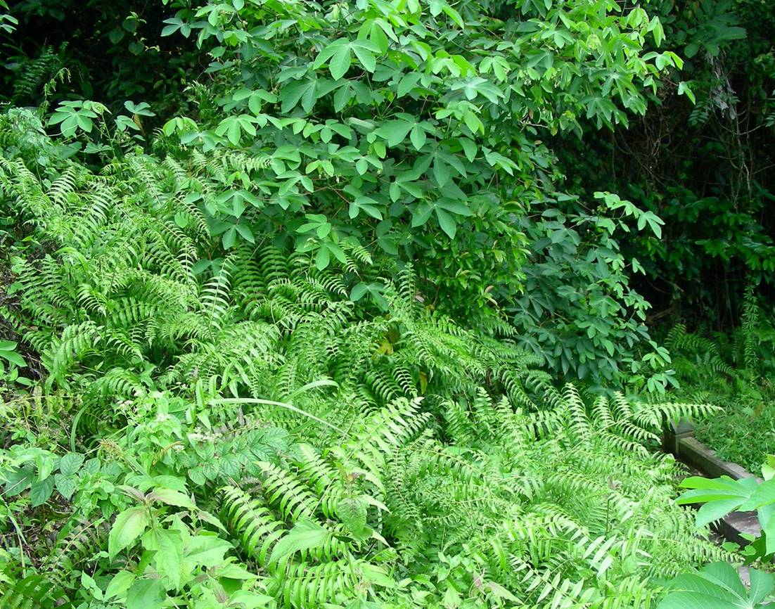
An edible fern, delicious saute with sambal belachan (a Malaysian dish) according to Angie (photo; Angie Ng)
Ferns also grow on hospitable rain trees
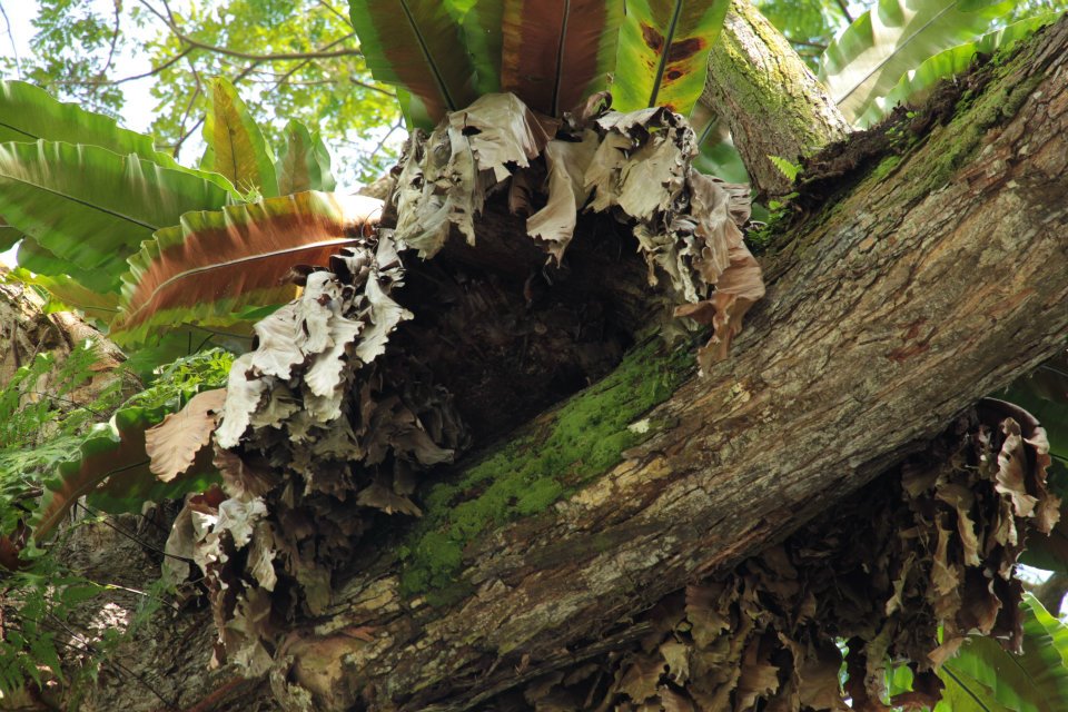
This bird’s nest fern in turn hosts a nest for a family of bats. Cuifen who took this photo spotted four. can you spot any?
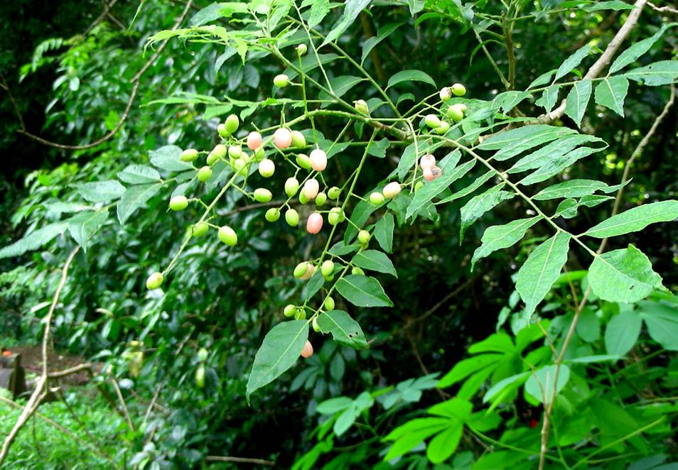
The False Curry Leaf Plant (Clausena excavata)
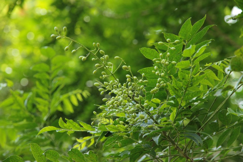
The False Curry Leaf Plant is a small tree which looks like a Curry Leaf plant and whose leaves also smell like it. But its small flowers are in panicles and its green oblong berries ripen pink. (photo Cuifen)
Geophila repens
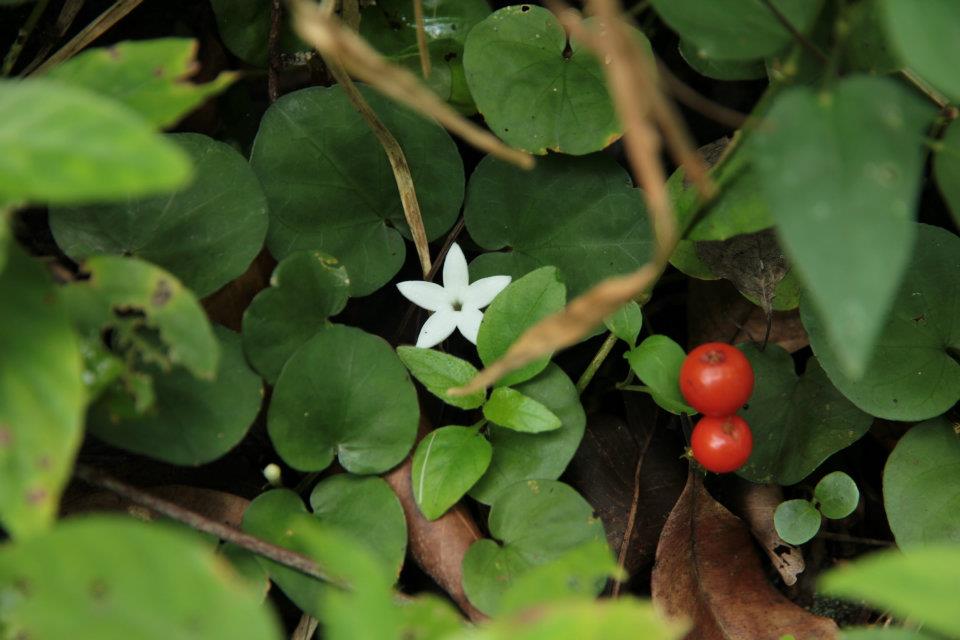
Geophilia repens with tiny white flower and bright red berries creeps among the grasses under shady trees.
Salam Tree ( Syzygium polyanth )
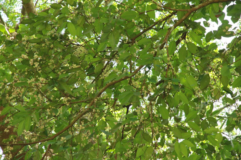
The Salam tree is flowering and dropping bunches of its creamy white stamens. Salam leaves are used to flavour your favourite local breakfast dish, lontong. (Photo: Cuifen)
The Napkin tree
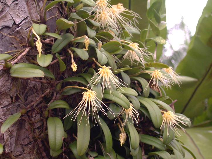
And the most spectacular of the flowering plants : Wild Orchids
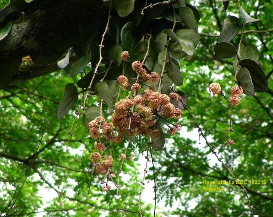
Hoya Latifolia – The waxed flowers hangs high on an old rain tree, leaves are almost heart shaped (photo by Angie Ng)
Read the NSS Position Paper on Bukit Brown
Dear Raymond,
I was wondering if you knew if there’s a name list for all of the people buried at Bukit Brown? Because my father says my great-grandfather is buried there, but he cannot remember the location of the tomb, and we would like to find it if possible.
Alvin Soon
Dear Alvin,
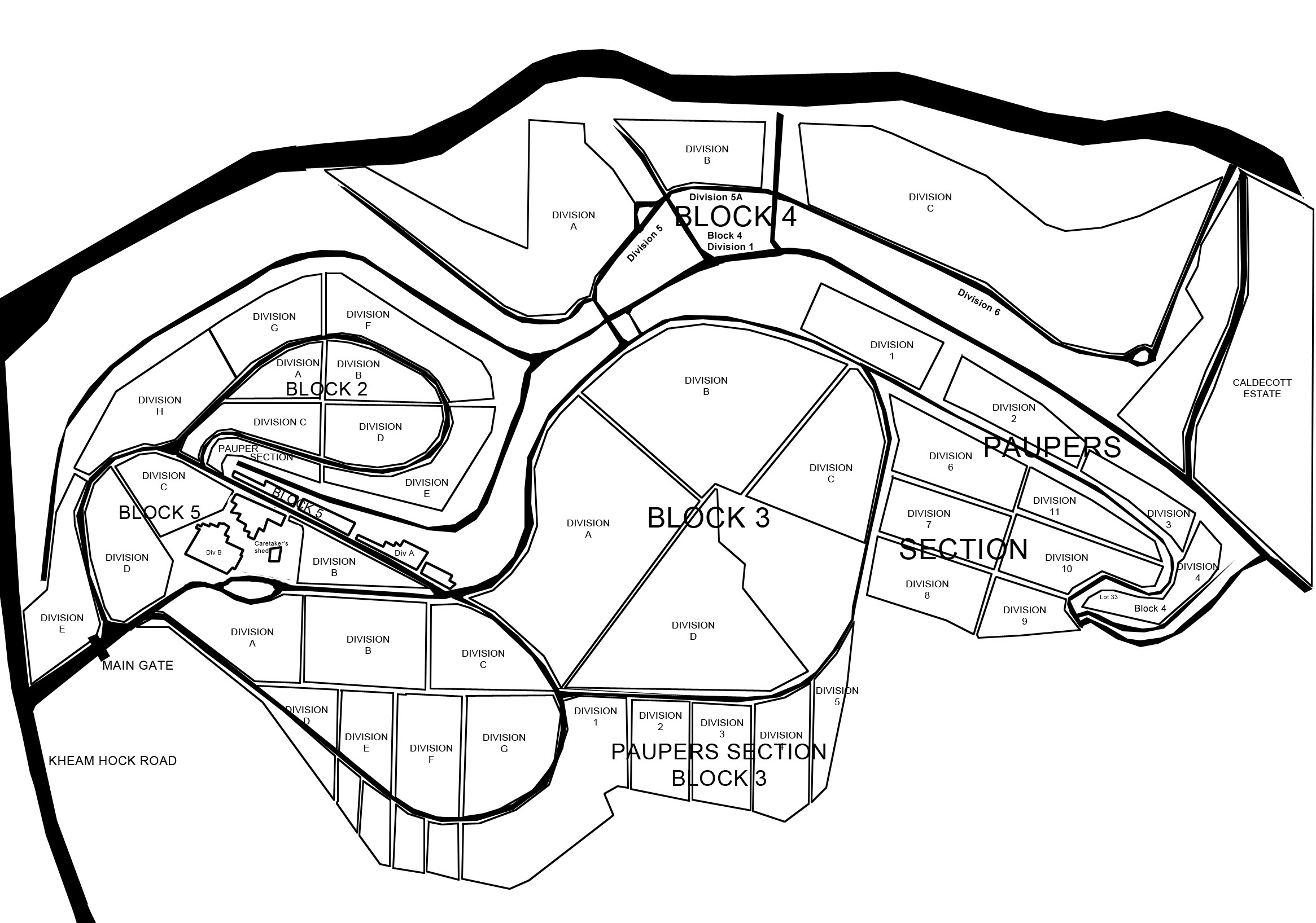
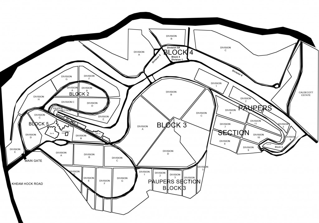
Start with the name of your great-grandfather and date of his death. The National Archives has made it easier to search online for his “address” which should state the block, division and plot number. You can find the records for the burial registry here
You can also try the newspaper archives for any mention of notices of death and if your great grandfather is a prominent member of the society in his lifetime, you may find more reports on him.
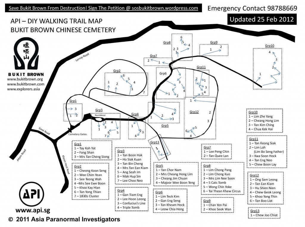
Once you have the block. division and plot number download this map
Finding an ancestral grave can be challenging if the family has not visited in a long while. The graveside may be overgrown. Also searching for plot numbers can be counter intuitive. The Bukit Brown Cemetery fell under 3 different administrations during its nearly 50 years of operations from 1923 – 1973 – the colonial government,the Japanese occupation and Singapore government. If on site, and you see tomb keepers in the area, they can be helpful. And if you still need help please contact us again. I wish you luck and hope you will be able to find your great grandfather by Qing Ming.
Regards,
Raymond Goh
Please note Updated 3 of Map.
Hot off the press updated map from Goh brothers who have also done maintenance work on red and white markers. Self guided tours now a breeze. Enjoy
Having issues, go direct to the source
For an interactive rendition of this map, created by Pui Cuifen and assisted by Lim Su-Min, among other Bukit Brown elves, click here and zoom in.
The map below is useful for navigating Bukit Brown in tandem with map with tombs of interest.
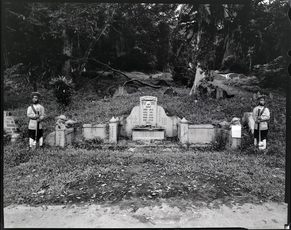
This tomb marked as Y on the map belonging to Chew Geok Leong is an example of a “live” tomb.
No, the Sikh Guards don’t come alive at night. A “live” tomb is one where the deceased played a part in the design of his final resting place while still alive. In this case, Chew – a Chinese physician – conceptualised an elaborate design which included his own modest terra cotta army of 2 Sikh Guards . A “live” tomb is usually undertaken to ensure the well being of future generations on the recommendation of a Chinese Feng Shui master after a reading.
If you have any questions for Raymond, please email to a.t.bukitbrown@gmail.com
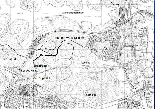
Bukit Brown Cemetery is named after George Henry Brown who came to Singapore in 1840 to start a shipping business. He bought up an area of roughly 200 acres which covered rolling hills. The Malay word for hill is “bukit” and “sua” is hill in the Hokkien dialect.
After Brown’s death the land passed through the hands of Mootapa Chitty ( a Chettair ) and Lim Chu Yi ( a Chinese businessman).
In 1872, it was bought by 3 clansman from the Ong Clan each paying $500. The land was donated to the Hokkien Clan Association without condition for dwelling, farming and burials. It was called “Seh Ong Sua”
In 1918/1919, the colonial government paid about $24.500 for a portion of the Ong burial site (97 acres) to be used as a Chinese Municipal Cemetery opened to all Chinese, rich or poor. From a private cemetery for the Ong Clan and the Hokkien community, it became a public cemetery known as Bukit Brown Cemetery in 1923.
Kopi Sua refers to the area near Mount Pleasant Road where Brown lived, which was originally named Brown’s Hill. One reason offered as to why it is called Kopi Sua – Hokkien for Coffee Hill – is that in the dialect there is no equivalent to the colour Brown. So “kopi” was the next best thing. The other reason is Brown attempted to grow coffee on the estate but it didn’t take.
What is now known as the Bukit Brown Cemetery includes 50 acres known as Lau Sua (Old Hill) which was opened and managed by the Hokkien Huay Kuan as a cemetery in 1892. So the short answer is Kopi Sua is not Bukit Brown Cemetery and vice versa. The Bukit Brown Municipal Cemetery ceased operations in 1973
For self-guiding, please refer to our tour guides and featured tombs. Read up on tips before you visit for full enjoyment and safety. Enjoy the flora and fauna.
***
Division Map
***
We are often asked about the distances over Bukit Brown. Cyclists and runners may find these useful:
For the greater Bukit Brown cemetery complex:
Mok Ly Yng says:
The Seh Ong Cemetery was made up of 5 hills since day 1. Lornie/Adam Road only cut thru the valley between Hill 4/5 (on the golf course side) and the rest of Hills 1-3 on the BBC side. Then later on, PIE came in and cut thru the lower areas of the Hills 1 and 2.
Seh Ong had 5 hills since the area was acquired in the 19th century. Still today, the hill tops are still around, but the ‘body’ of the hills are badly bisected by the two roads (Lornie/Adam Rds and PIE).
Kheam Hock Road also cut thru a valley between the Seh Ong Hills 1 (left) and 2/3 (right), does not affect the hill count.







Recent Comments